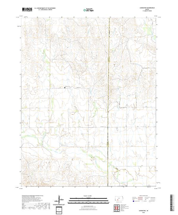
2022 Map of Lexington
USGS Topo · Published 2022About this map
Bluff Creek and its many tributaries, including Cavalry Creek and Lone Tree Creek, carve a complex drainage pattern through this section of the High Plains. Located along the boundary of Clark and Comanche Counties, this landscape is defined by the deep incisions of watercourses against the plateau. The rural character of the area is centered around the Lexington Cemetery situated on Cemetery Road. The map provides a detailed view of the regional road network, tracing the path of Old Highway 34 as it moves east toward the county line. The transition from established routes like CR 31 to the system of section-line roads such as Avenue D and Avenue G illustrates the enduring grid-based settlement pattern of Southwest Kansas.
Find a feature on this map
31 named features on this map. Tap any name to fly to it.
Don’t see what you’re looking for? This feature index may not catch every label — zoom into the map to look around manually.
Map Details
Editions of this 2022 Lexington Map
This is the sole edition of this map. No revisions or reprints were ever made.
Other maps of this area

1892 · Coldwater
USGS Topo · 1:125,000

1894 · Sitka
USGS Topo · 1:62,500

1896 · Ashland
USGS Topo · 1:125,000

1955 · Pratt
USGS Topo · 1:250,000

1959 · Pratt
USGS Topo · 1:250,000

1979 · Sitka
USGS Topo · 1:24,000

1979 · Sugarloaf
USGS Topo · 1:24,000

1979 · Turkey Creek
USGS Topo · 1:24,000

1979 · East Kiowa Creek South
USGS Topo · 1:24,000
1979 · East Kiowa Creek North
USGS Topo · 1:24,000