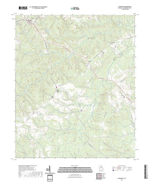
2024 Map of Lexington
USGS Topo · Published 2024About this map
The Oglethorpe County Courthouse serves as the focal point of Lexington, a community defined by its long-standing ecclesiastical and civic geography. This Oglethorpe County landscape is deeply marked by its ancestral lineage, evidenced by a high density of family and congregational burial grounds including the Lexington Presbyterian Church Cem, Dozier Rees Cem, and the Thaxton Wynne Cem. The terrain is characterized by a network of creeks, such as Troublesome Creek and Buffalo Creek, which carve through the land around Big Mountain. These watercourses dictate the winding paths of rural routes like Washington Rd and Crawfordville Rd, connecting the town to outlying areas like Hogan. The map captures a transition from the structured town grid of Lexington into a more dispersed agricultural and forest pattern where churches like Clarks Grove Baptist Cem served as vital community anchors.
Find a feature on this map
66 named features on this map. Tap any name to fly to it.
Don’t see what you’re looking for? This feature index may not catch every label — zoom into the map to look around manually.
Map Details
Editions of this 2024 Lexington Map
This is the sole edition of this map. No revisions or reprints were ever made.
Other maps of this area

1906 · Crawfordville
USGS Topo · 1:125,000

1953 · Athens
USGS Topo · 1:250,000

1958 · Athens
USGS Topo · 1:250,000

1959 · Athens
USGS Topo · 1:250,000

1963 · Athens
USGS Topo · 1:250,000

1965 · Woodville
USGS Topo · 1:24,000

1966 · Philomath
USGS Topo · 1:24,000
1971 · Sandy Cross
USGS Topo · 1:24,000
1971 · Crawford
USGS Topo · 1:24,000

1971 · Maxeys
USGS Topo · 1:24,000