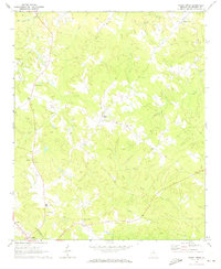
1971 Map of Sandy Cross
USGS Topo · Published 1973About this map
Sandy Cross serves as a central hub in this Oglethorpe County landscape, where rural communities are defined by a network of local congregations and small-scale industry. The map reveals a dense distribution of religious sites including Mt Pleasant Ch, St Pauls Ch, and Glade Churches, alongside several unnamed cemeteries that suggest long-established family homesteads. The northern reaches near Point Peter are marked by several Quarries, indicating the importance of local stone extraction to the area's economy.
Find a feature on this map
26 named features on this map. Tap any name to fly to it.
Don’t see what you’re looking for? This feature index may not catch every label — zoom into the map to look around manually.
Map Details
Editions of this 1971 Sandy Cross Map
2 editions found
Other maps of this area

1891 · Carnesville
USGS Topo · 1:125,000

1893 · Elberton
USGS Topo · 1:125,000

1906 · Crawfordville
USGS Topo · 1:125,000

1953 · Athens
USGS Topo · 1:250,000

1954 · Greenville
USGS Topo · 1:250,000

1958 · Greenville
USGS Topo · 1:250,000

1958 · Athens
USGS Topo · 1:250,000

1958 · Danielsville
USGS Topo · 1:62,500

1958 · Elberton
USGS Topo · 1:62,500

1959 · Athens
USGS Topo · 1:250,000