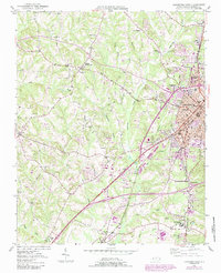
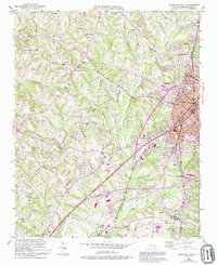
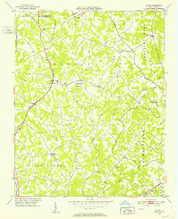
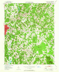
1950 Map of Lexington West
USGS Topo · Published 1987About this map
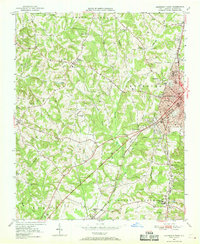
Lexington stands at the eastern edge of this landscape, its industrial character evidenced by the mill village of Erlanger and the extensive rail infrastructure of the Southern and Winston-Salem Southbound railroads. Surveyed mid-century and revised in the 1980s, the map reveals a transition from rural agricultural crossroads like Reeds Crossroads and Dykers to modern commercial features including a Drive-in Theater and the Lexington Municipal Airport.
Find a feature on this map
48 named features on this map. Tap any name to fly to it.
Don’t see what you’re looking for? This feature index may not catch every label — zoom into the map to look around manually.
Map Details
Editions of this 1950 Lexington West Map
3 editions found
Other maps of this area

1949 · Denton NW
USGS Topo · 1:24,000
1949 · Eller
USGS Topo · 1:24,000
1950 · Lexington East
USGS Topo · 1:24,000
1950 · Lexington West
USGS Topo · 1:24,000
1950 · Churchland
USGS Topo · 1:24,000

1951 · Churchland
USGS Topo · 1:24,000

1951 · Lexington East
USGS Topo · 1:24,000

1951 · Lexington West
USGS Topo · 1:24,000

1953 · Charlotte
USGS Topo · 1:250,000

1954 · Charlotte
USGS Topo · 1:250,000