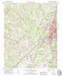
1950 Map of Lexington West
USGS Topo · Published 1994About this map
The industrial and civic heart of Davidson County beats at Lexington, where the concentration of rail infrastructure and local government buildings, such as the Courthouse, anchors the community. To the north, the mill town character of Erlanger stands out, while the southern reaches near Linwood show the intersection of the railroad and the Lexington Municipal Airport. The landscape is a network of small family-centered settlements and rural crossroads like Reeds Crossroads and Jakesville, each defined by local institutions like Reeds Sch or the Mt Carmel Ch.
Find a feature on this map
44 named features on this map. Tap any name to fly to it.
Don’t see what you’re looking for? This feature index may not catch every label — zoom into the map to look around manually.
Map Details
Editions of this 1950 Lexington West Map
3 editions found
Other maps of this area

1949 · Denton NW
USGS Topo · 1:24,000

1949 · Eller
USGS Topo · 1:24,000

1950 · Lexington East
USGS Topo · 1:24,000

1950 · Lexington West
USGS Topo · 1:24,000

1950 · Churchland
USGS Topo · 1:24,000

1951 · Churchland
USGS Topo · 1:24,000

1951 · Lexington East
USGS Topo · 1:24,000

1951 · Lexington West
USGS Topo · 1:24,000

1953 · Charlotte
USGS Topo · 1:250,000

1954 · Charlotte
USGS Topo · 1:250,000