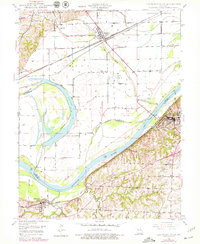
1949 Map of Lexington West
USGS Topo · Published 1979About this map
Lexington Battle Ground anchors the eastern river bluffs in this mid-century survey, looking out over the wide oxbow of Sunshine Lake and the floodplain of Camden Bend. The Missouri River's influence is clear through the extensive levee systems and river-centered infrastructure, including the Lexington Landing Field and Gaging Sta. The industrial footprint of the era is evident in the numerous Mine Dumps and coal-related activities near Myrick, while the local railroad economy is defined by the Atchison Topeka and Santa Fe, Wabash, and Missouri Pacific lines which intersect at Henrietta. Rural life is preserved through family landmarks such as Foster Cem and Linden Sch, showing the distribution of early settlements before modern expansion altered the landscape around Wellington and Lexington.
Find a feature on this map
31 named features on this map. Tap any name to fly to it.
Don’t see what you’re looking for? This feature index may not catch every label — zoom into the map to look around manually.
Map Details
Editions of this 1949 Lexington West Map
3 editions found
Other maps of this area

1889 · Lexington
USGS Topo · 1:125,000

1894 · Independence
USGS Topo · 1:125,000

1949 · Mayview
USGS Topo · 1:24,000

1949 · Lexington East
USGS Topo · 1:24,000

1949 · Lexington West
USGS Topo · 1:24,000

1949 · Odessa North
USGS Topo · 1:24,000

1950 · Lexington East
USGS Topo · 1:24,000

1950 · Mayview
USGS Topo · 1:24,000

1950 · Kansas City
USGS Topo · 1:250,000

1950 · Odessa North
USGS Topo · 1:24,000