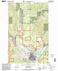
1997 Map of Libby
USGS Topo · Published 2000About this map
The town of Libby sits along the southern bank of the Kootenai River in this late 1990s survey, serving as a hub for the surrounding Kootenai National Forest. The map detail reveals the community's civic infrastructure, from schools like Plummer Sch, Libby High School, and Asa Wood Jr HS to the Forest Supervisors Headquarters. To the north and east, the landscape is defined by the steep elevation of Bobtail Ridge, Lindy Peak, and Sheldon Mountain, while the river valley floor accommodates various Gravel Pits and a Mobile Home Park near the mouth of Bobtail Creek. Local recreation and service features are carefully noted, including Pioneer Park, the Drive-in Theater west of town, and an extensive network of creeks like Libby Creek and Flower Creek that converge near the settlement. The inclusion of the Bobtail Cutoff and several 4wd trails indicates the rugged timber and mining access routes typical of this Montana mountain corridor.
Find a feature on this map
39 named features on this map. Tap any name to fly to it.
Don’t see what you’re looking for? This feature index may not catch every label — zoom into the map to look around manually.
Map Details
Editions of this 1997 Libby Map
This is the sole edition of this map. No revisions or reprints were ever made.
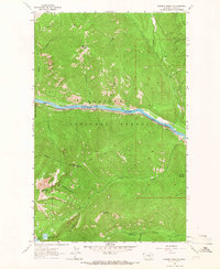
Other maps of this area

1920 · Libby
USGS Topo · 1:125,000

1920 · Jennings
USGS Topo · 1:125,000

1930 · Libby
USGS Topo · 1:125,000
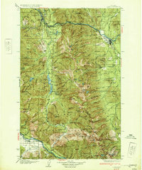
1932 · Libby
USGS Topo · 1:125,000

1935 · Thompson Lakes
USGS Topo · 1:96,000

1942 · Thompson Lakes
USGS Topo · 1:125,000

1957 · Kalispell
USGS Topo · 1:250,000

1960 · Kalispell
USGS Topo · 1:250,000

1961 · Kalispell
USGS Topo · 1:250,000
1963 · Scenery Mountain
USGS Topo · 1:24,000