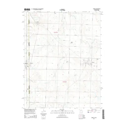
2015 Map of Liberal
USGS Topo · Published 2015About this map
The town of Liberal anchors this section of the Missouri-Kansas border, situated just east of the Crawford Co Barton Co line. This landscape is defined by the headwaters of the Dry Wood Cr system, which drains the undulating plains of Barton County. In the early 21st century, the area retains a dense network of sectional roads and small rural settlements, reflecting a long-standing agricultural and mining heritage. To the west, the community of Mulberry and the smaller enclave of Burgess sit directly on the state line, while Ardath and Fuller mark the northern and southern reaches of this transition zone. Notable local landmarks include several burial grounds such as Leroy Cemetery and Rosebank Cemetery, as well as the prominent elevation of Haake Mound and the waters of Roses Lake to the southeast.
Find a feature on this map
36 named features on this map. Tap any name to fly to it.
Don’t see what you’re looking for? This feature index may not catch every label — zoom into the map to look around manually.
Map Details
Editions of this 2015 Liberal Map
This is the sole edition of this map. No revisions or reprints were ever made.
Other maps of this area

1884 · Fort Scott
USGS Topo · 1:125,000

1886 · Nevada
USGS Topo · 1:125,000

1886 · Joplin
USGS Topo · 1:125,000

1886 · Fort Scott
USGS Topo · 1:125,000

1886 · Carthage
USGS Topo · 1:125,000

1893 · Fort Scott
USGS Topo · 1:125,000

1894 · Nevada
USGS Topo · 1:125,000

1894 · Joplin
USGS Topo · 1:125,000

1894 · Carthage
USGS Topo · 1:125,000

1945 · Pittsburg
USGS Topo · 1:62,500