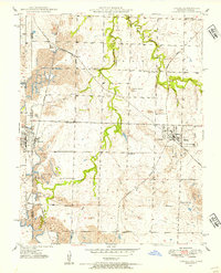
1948 Map of Liberal
USGS Topo · Published 1954About this map
The Kansas-Missouri state line defines the western edge of this 1948 survey, where the border between Crawford County and Barton County meets a landscape heavily shaped by the coal industry. Extensive strip mines dominate the terrain, particularly around the settlements of Mulberry, Burgess, and Fuller. The town of Liberal serves as a central hub, connected by a dense network of railroads including the St. Louis-San Francisco, Missouri Pacific, and Kansas City Southern.
Find a feature on this map
30 named features on this map. Tap any name to fly to it.
Don’t see what you’re looking for? This feature index may not catch every label — zoom into the map to look around manually.
Map Details
Editions of this 1948 Liberal Map
This is the sole edition of this map. No revisions or reprints were ever made.
Other maps of this area

1884 · Fort Scott
USGS Topo · 1:125,000

1886 · Nevada
USGS Topo · 1:125,000

1886 · Joplin
USGS Topo · 1:125,000

1886 · Fort Scott
USGS Topo · 1:125,000

1886 · Carthage
USGS Topo · 1:125,000

1893 · Fort Scott
USGS Topo · 1:125,000

1894 · Nevada
USGS Topo · 1:125,000

1894 · Joplin
USGS Topo · 1:125,000

1894 · Carthage
USGS Topo · 1:125,000

1945 · Pittsburg
USGS Topo · 1:62,500