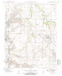
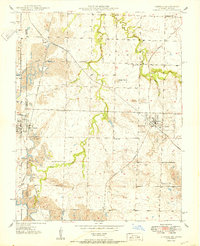
1950 Map of Liberal
USGS Topo · Published 1985About this map
The town of Liberal anchors this 1950 mid-century survey of the Kansas-Missouri borderlands. This landscape is defined by the heavy footprint of the coal industry, with numerous Strip Mines and extensive pits concentrated west of town. The area’s infrastructure is deeply tied to the intersection of three major railroads: the St Louis San Francisco, the Missouri Pacific, and the Kansas City Southern. Beyond the industrial activity, the map reveals a dense network of rural school districts and small settlements such as Ardath, Burgess, and Mulberry. Waterways like Dry Wood Creek and Nicolson Creek provide the primary drainage through the rolling terrain, while Haake Mound stands as a notable natural elevation in this border country.
Find a feature on this map
28 named features on this map. Tap any name to fly to it.
Don’t see what you’re looking for? This feature index may not catch every label — zoom into the map to look around manually.
Map Details
Editions of this 1950 Liberal Map
2 editions found
Other maps of this area

1884 · Fort Scott
USGS Topo · 1:125,000

1886 · Nevada
USGS Topo · 1:125,000

1886 · Joplin
USGS Topo · 1:125,000

1886 · Fort Scott
USGS Topo · 1:125,000

1886 · Carthage
USGS Topo · 1:125,000

1893 · Fort Scott
USGS Topo · 1:125,000

1894 · Nevada
USGS Topo · 1:125,000

1894 · Joplin
USGS Topo · 1:125,000

1894 · Carthage
USGS Topo · 1:125,000

1945 · Pittsburg
USGS Topo · 1:62,500