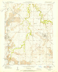
1950 Map of Liberal
USGS Topo · Published 1950About this map
Extensive strip mining operations dominate the landscape of Barton County and the Kansas border at the mid-century, carving deep pits across the terrain between Ardath and Liberal. The area's heavy industrial character is defined by a dense network of rail lines, including the St Louis - San Francisco, Kansas City Southern, and Missouri Pacific railroads, which served the numerous Strip Mines that surround the local settlements.
Find a feature on this map
33 named features on this map. Tap any name to fly to it.
Don’t see what you’re looking for? This feature index may not catch every label — zoom into the map to look around manually.
Map Details
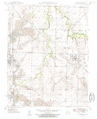
Editions of this 1950 Liberal Map
2 editions found
Other maps of this area

1884 · Fort Scott
USGS Topo · 1:125,000

1886 · Nevada
USGS Topo · 1:125,000

1886 · Joplin
USGS Topo · 1:125,000

1886 · Fort Scott
USGS Topo · 1:125,000

1886 · Carthage
USGS Topo · 1:125,000

1893 · Fort Scott
USGS Topo · 1:125,000

1894 · Nevada
USGS Topo · 1:125,000

1894 · Joplin
USGS Topo · 1:125,000

1894 · Carthage
USGS Topo · 1:125,000

1945 · Pittsburg
USGS Topo · 1:62,500