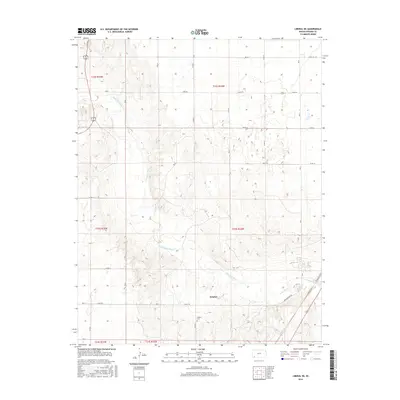
2016 Map of Liberal NE
USGS Topo · Published 2016About this map
Cimarron River winds through the heart of this Seward County landscape, cutting a wide, sandy path through the Kansas plains. The settlement of Arkalon stands as the primary anchor for the area, situated along the river's northern bank. This 2016 survey illustrates a rural environment defined by a grid of section-line roads, such as Kane Rd and Triple Rd, which provide access to the vast agricultural and ranching parcels common in this part of the state. Genealogists and local historians will find the Arkalon Cem particularly noteworthy, located south of the river near the junction of 7 Mile Rd and Co Rd O. The proximity of Arkalon Park Rd to the river suggests a landscape used for both irrigation and recreation, while the presence of major thoroughfares like 83 160 in the northwest corner highlights the connectivity of this remote region to larger regional hubs.
Find a feature on this map
28 named features on this map. Tap any name to fly to it.
Don’t see what you’re looking for? This feature index may not catch every label — zoom into the map to look around manually.
Map Details
Editions of this 2016 Liberal NE Map
This is the sole edition of this map. No revisions or reprints were ever made.
Other maps of this area

1955 · Dodge City
USGS Topo · 1:250,000

1958 · Dodge City
USGS Topo · 1:250,000

1959 · Dodge City
USGS Topo · 1:250,000

1968 · Plains SW
USGS Topo · 1:24,000

1968 · Sublette SW
USGS Topo · 1:24,000

1968 · Liberal NE
USGS Topo · 1:24,000

1968 · Sublette SE
USGS Topo · 1:24,000

1968 · Liberal NW
USGS Topo · 1:24,000

1971 · Liberal
USGS Topo · 1:24,000
1971 · Kismet
USGS Topo · 1:24,000