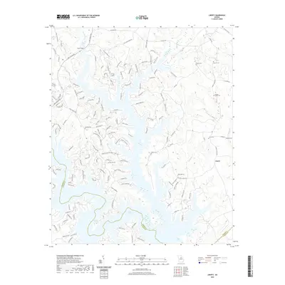
2020 Map of Liberty
USGS Topo · Published 2020About this map
The sprawling waters of Lake Oconee dominate this landscape where Greene Co, Putnam Co, and Hancock Co meet. This era is defined by the transformation of the Oconee River valley into a major reservoir, yet the map preserves the older rural character through its numerous family burying grounds. Genealogists can trace sites like Rowland Cem, Ward Hill Cem, and the Copelan-Credille Cem, which remain as markers of the area's agricultural past before the flooding of the basin. Along the eastern reaches, the settlement of Liberty stands near Double Cr, while to the west, Fuller Bridge spans a northern arm of the lake. Submerged features and river remnants such as Riley Shoals and Long Shoals provide insight into the original riverbed topography now masked by the impoundment.
Find a feature on this map
150 named features on this map. Tap any name to fly to it.
Don’t see what you’re looking for? This feature index may not catch every label — zoom into the map to look around manually.
Map Details
Editions of this 2020 Liberty Map
This is the sole edition of this map. No revisions or reprints were ever made.
Other maps of this area

1953 · Athens
USGS Topo · 1:250,000

1958 · Athens
USGS Topo · 1:250,000

1959 · Athens
USGS Topo · 1:250,000

1963 · Athens
USGS Topo · 1:250,000

1965 · Union Point
USGS Topo · 1:24,000

1972 · Liberty
USGS Topo · 1:24,000

1972 · Shoulderbone
USGS Topo · 1:24,000

1972 · Meda
USGS Topo · 1:24,000

1972 · Buckhead
USGS Topo · 1:24,000

1972 · Harmony
USGS Topo · 1:24,000