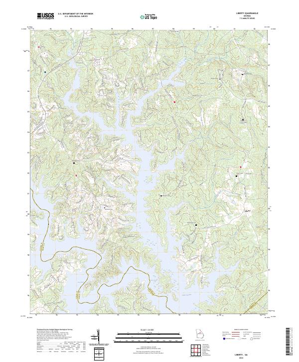
2024 Map of Liberty
USGS Topo · Published 2024About this map
Lake Oconee dominates this Georgia landscape where the waters of the Oconee River meet the boundaries of Greene, Putnam, and Hancock counties. The map documents a complex shoreline of deep coves and peninsulas, reflecting a modern topography shaped by the impoundment of the river. Despite the contemporary water levels, submerged features of the original riverbed like Long Shoals and Riley Shoals remain identified, marking the historical fall line terrain.
Find a feature on this map
148 named features on this map. Tap any name to fly to it.
Don’t see what you’re looking for? This feature index may not catch every label — zoom into the map to look around manually.
Map Details
Editions of this 2024 Liberty Map
This is the sole edition of this map. No revisions or reprints were ever made.
Other maps of this area

1953 · Athens
USGS Topo · 1:250,000

1958 · Athens
USGS Topo · 1:250,000

1959 · Athens
USGS Topo · 1:250,000

1963 · Athens
USGS Topo · 1:250,000

1965 · Union Point
USGS Topo · 1:24,000

1972 · Liberty
USGS Topo · 1:24,000

1972 · Shoulderbone
USGS Topo · 1:24,000

1972 · Meda
USGS Topo · 1:24,000

1972 · Buckhead
USGS Topo · 1:24,000

1972 · Harmony
USGS Topo · 1:24,000