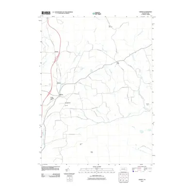
2010 Map of Liberty
USGS Topo · Published 2010About this map
Liberty and its surrounding hamlets occupy a high-relief landscape in Tioga County, defined by the deep incisions of Blockhouse Creek and the Roaring Branch. In the early 21st century, the area maintains a rural character where traditional settlements like Henslertown, Veilstown, and Sebring are linked by a network of winding roads following the natural hollows and ridges. The map reveals local landmarks such as Jew Hill and the House Landing Strip, pointing to a blend of agricultural life and small-scale aviation.
Find a feature on this map
52 named features on this map. Tap any name to fly to it.
Don’t see what you’re looking for? This feature index may not catch every label — zoom into the map to look around manually.
Map Details
Editions of this 2010 Liberty Map
This is the sole edition of this map. No revisions or reprints were ever made.
Other maps of this area

1921 · Trout Run
USGS Topo · 1:62,500

1923 · Trout Run
USGS Topo · 1:62,500

1925 · Blossburg
USGS Topo · 1:62,500

1927 · Blossburg
USGS Topo · 1:62,500

1930 · Warrensville
USGS Topo · 1:62,500

1934 · Warrensville
USGS Topo · 1:62,500

1942 · Canton
USGS Topo · 1:62,500

1944 · Blossburg
USGS Topo · 1:62,500

1944 · Trout Run
USGS Topo · 1:62,500

1944 · Canton
USGS Topo · 1:62,500
Featured Places
- Liberty, PA
- Veilstown, Liberty Township
- Henslertown, Liberty Township
- McIntyre Township, PA
- Union Township, PA