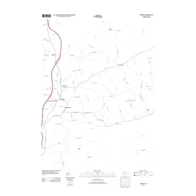
2013 Map of Liberty
USGS Topo · Published 2013About this map
Liberty serves as the central hub of this northern Pennsylvania landscape, where the confluence of several local routes meets along Blockhouse Cr. The map reveals a network of small upland settlements including Sebring, Veilstown, and Henslertown, connected by roads that often follow the natural contours of the stream valleys. Distinctive infrastructure like House Landing Strip and specific local markers such as Jew Hill and Brick Church Rd provide clear touchpoints for local historians and genealogists tracking family properties in the early 21st century.
Find a feature on this map
75 named features on this map. Tap any name to fly to it.
Don’t see what you’re looking for? This feature index may not catch every label — zoom into the map to look around manually.
Map Details
Editions of this 2013 Liberty Map
This is the sole edition of this map. No revisions or reprints were ever made.
Other maps of this area

1921 · Trout Run
USGS Topo · 1:62,500

1923 · Trout Run
USGS Topo · 1:62,500

1925 · Blossburg
USGS Topo · 1:62,500

1927 · Blossburg
USGS Topo · 1:62,500

1930 · Warrensville
USGS Topo · 1:62,500

1934 · Warrensville
USGS Topo · 1:62,500

1942 · Canton
USGS Topo · 1:62,500

1944 · Blossburg
USGS Topo · 1:62,500

1944 · Trout Run
USGS Topo · 1:62,500

1944 · Canton
USGS Topo · 1:62,500
Featured Places
- Liberty, PA
- Veilstown, Liberty Township
- Henslertown, Liberty Township
- McIntyre Township, PA
- Union Township, PA