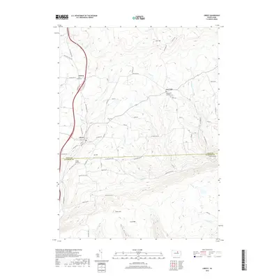
2019 Map of Liberty
USGS Topo · Published 2019About this map
Liberty sits at the base of the high plateau country in southern Tioga County, where a network of rural roads and mountain runs converges. This modern topographic survey illustrates a landscape deeply rooted in its 19th-century settlement patterns, particularly evident in the high density of small cemeteries such as Union Cem, Sebring Cem, and the Old East Point - Ebenezer Church/Yard Cem. The terrain is defined by dramatic relief, ranging from the steep slopes of Brier Mtn to the narrow valleys carved by Blockhouse Cr and Little Elk River. A significant local boundary is marked where the quadrangle meets the Tioga Co Lycoming Co line, crossing through high points like Jew Hill and Hickory Knob. This map is particularly useful for identifying family-named landmarks and the precise locations of small rural parishes such as Friedens Lutheran Church Cem near the southern border.
Find a feature on this map
80 named features on this map. Tap any name to fly to it.
Don’t see what you’re looking for? This feature index may not catch every label — zoom into the map to look around manually.
Map Details
Editions of this 2019 Liberty Map
This is the sole edition of this map. No revisions or reprints were ever made.
Other maps of this area

1921 · Trout Run
USGS Topo · 1:62,500

1923 · Trout Run
USGS Topo · 1:62,500

1925 · Blossburg
USGS Topo · 1:62,500

1927 · Blossburg
USGS Topo · 1:62,500

1930 · Warrensville
USGS Topo · 1:62,500

1934 · Warrensville
USGS Topo · 1:62,500

1942 · Canton
USGS Topo · 1:62,500

1944 · Blossburg
USGS Topo · 1:62,500

1944 · Trout Run
USGS Topo · 1:62,500

1944 · Canton
USGS Topo · 1:62,500
Featured Places
- Liberty, PA
- Veilstown, Liberty Township
- Henslertown, Liberty Township
- McIntyre Township, PA
- Union Township, PA