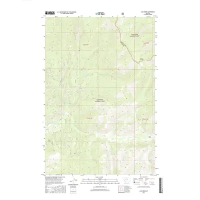
2017 Map of Lick Creek
USGS Topo · Published 2017About this map
Bitterroot National Forest and Deer Lodge National Forest meet in this high-altitude landscape along the border of Granite and Ravalli counties. The valley of the East Fork Bitterroot River serves as the primary drainage and corridor for movement, supported by a network of forest service roads including Martin Creek Rd and E Fork Rd. The terrain is defined by a complex system of mountain tributaries such as Lick Cr, Moose Cr, and Clifford Cr that carve through the timberland. While largely wilderness, the map identifies specific geographic landmarks like Hole in the Wall and Echo Gulch, alongside the small level area of Kurtz Flats. This survey illustrates the 2017 state of these protected federal lands, where narrow access roads like Leisure Ln and McCart Rd reach into the dense backcountry.
Find a feature on this map
34 named features on this map. Tap any name to fly to it.
Don’t see what you’re looking for? This feature index may not catch every label — zoom into the map to look around manually.
Map Details
Editions of this 2017 Lick Creek Map
This is the sole edition of this map. No revisions or reprints were ever made.
Other maps of this area

1909 · Sapphire
USGS Topo · 1:125,000

1947 · Butte
USGS Topo · 1:250,000

1955 · Dillon
USGS Topo · 1:250,000

1957 · Dillon
USGS Topo · 1:250,000

1958 · Butte
USGS Topo · 1:250,000

1958 · Dillon
USGS Topo · 1:250,000

1960 · Butte
USGS Topo · 1:250,000

1962 · Butte
USGS Topo · 1:250,000

1962 · Dillon
USGS Topo · 1:250,000

1965 · Dillon
USGS Topo · 1:250,000