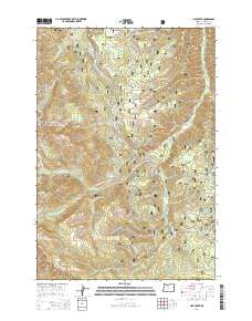
2014 Map of Lick Creek
USGS Topo · Published 2014About this map
Wallowa National Forest dominates this section of the high Wallowa Mountains, where complex water management systems and remote forest roads define the landscape. A significant engineering feature, the Wallowa Valley Improvement Canal, traverses the high elevations to redirect water from the Big Sheep Cr drainage toward the valley. This 2014 survey documents the dense network of Forest Service roads including the Wallowa Mountain Loop and Coverdale Rd, which provide access to high-altitude landmarks like Tyee Butte and the Imnaha Divide. The area is defined by its dramatic relief, moving from the depths of Echo Canyon to the heights of Blue Jay Ridge and Wing Ridge. Water sources essential for backcountry travel and livestock are clearly marked at Target Spring and Wayside Spring, illustrating the continued importance of these named points in the contemporary forest management era.
Find a feature on this map
35 named features on this map. Tap any name to fly to it.
Don’t see what you’re looking for? This feature index may not catch every label — zoom into the map to look around manually.
Map Details
Editions of this 2014 Lick Creek Map
This is the sole edition of this map. No revisions or reprints were ever made.
Other maps of this area

1954 · Cornucopia
USGS Topo · 1:62,500

1954 · Harl Butte
USGS Topo · 1:62,500

1955 · Grangeville
USGS Topo · 1:250,000

1957 · Joseph
USGS Topo · 1:62,500

1957 · Homestead
USGS Topo · 1:62,500

1959 · Grangeville
USGS Topo · 1:250,000

1986 · Enterprise
USGS Topo · 1:100,000

1987 · Riggins
USGS Topo · 1:100,000
1990 · Deadman Point
USGS Topo · 1:24,000
1990 · Gumboot Butte
USGS Topo · 1:24,000