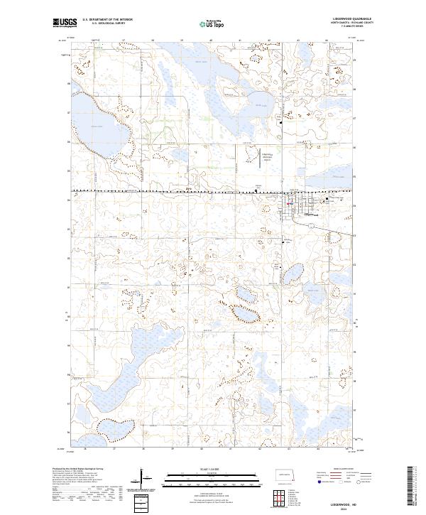
2024 Map of Lidgerwood
USGS Topo · Published 2024About this map
Lidgerwood serves as the central hub of this prairie landscape, defined by a grid of agricultural roads and numerous glacial lakes and wetlands. The town's layout is centered near the Lidgerwood Municipal Airport, with several established burial grounds including Pleasant View Cem, Holy Cross Cem, and the Catholic Cem clustered at its eastern edge. This distribution of cemeteries, which also includes the outlying Bohemian Cem and Saint Johns Cem, reflects the diverse heritage and family lineages that settled this portion of Richland County.
Find a feature on this map
46 named features on this map. Tap any name to fly to it.
Don’t see what you’re looking for? This feature index may not catch every label — zoom into the map to look around manually.
Map Details
Editions of this 2024 Lidgerwood Map
This is the sole edition of this map. No revisions or reprints were ever made.
Other maps of this area

1907 · Wyndmere
USGS Topo · 1:125,000

1953 · Milbank
USGS Topo · 1:250,000

1953 · Fargo
USGS Topo · 1:250,000

1956 · Fargo
USGS Topo · 1:250,000

1958 · Milbank
USGS Topo · 1:250,000

1958 · Veblen NE
USGS Topo · 1:24,000

1958 · Hamlin
USGS Topo · 1:24,000

1958 · Geneseo
USGS Topo · 1:24,000

1964 · Kreiser Lake
USGS Topo · 1:24,000

1964 · Moselle
USGS Topo · 1:24,000