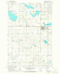
1964 Map of Lidgerwood
USGS Topo · Published 1965About this map
Lidgerwood serves as the primary hub of this Richland County landscape, situated at the junction of the Great Northern Line and an Old Railroad Grade that speaks to earlier transportation patterns. The surrounding prairies are defined by a complex network of glacial wetlands and water bodies, including Silver Lake, Bisek Lake, and the expansive Grass Lake. This 1964 survey captures the township's religious and civic infrastructure through the placement of the Bohemian Cem, St Johns Cem, and a rural Townhall. The presence of the Duerr Landing Strip and a Sewage Disposal Pond near the town center reflect mid-century utility and infrastructure developments. Further south, Wahl Lake and Elm Lake dot the landscape, illustrating the natural drainage patterns of the Grant and Duerr townships before modern large-scale land alterations.
Find a feature on this map
22 named features on this map. Tap any name to fly to it.
Don’t see what you’re looking for? This feature index may not catch every label — zoom into the map to look around manually.
Map Details
Editions of this 1964 Lidgerwood Map
This is the sole edition of this map. No revisions or reprints were ever made.
Other maps of this area

1907 · Wyndmere
USGS Topo · 1:125,000

1953 · Milbank
USGS Topo · 1:250,000

1953 · Fargo
USGS Topo · 1:250,000

1956 · Fargo
USGS Topo · 1:250,000

1958 · Milbank
USGS Topo · 1:250,000

1958 · Veblen NE
USGS Topo · 1:24,000

1958 · Hamlin
USGS Topo · 1:24,000

1958 · Geneseo
USGS Topo · 1:24,000

1964 · Kreiser Lake
USGS Topo · 1:24,000

1964 · Moselle
USGS Topo · 1:24,000