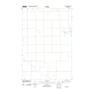
2011 Map of Liens Dams
USGS Topo · Published 2011About this map
Liens Dams serves as a focal point in this portion of Hettinger County, where the plains are defined by the winding paths of several drainage systems. The northern landscape is shaped by the meandering Tepee Creek, while the southern reaches are marked by the branching waters of Chanta Peta Creek. A distinct grid of rural routes, including Havelock Rd and 5th St NW, organizes the territory into large agricultural sections characteristic of southwestern North Dakota. This 2011 survey captures the area at a time when local water management and access via roads like Indian Cr Dam Rd remained essential to the ranching and farming operations that dominate the prairie. The proximity of Indian Creek in the northeast further illustrates the hydrological patterns that have historically dictated land use and settlement in this open country.
Find a feature on this map
12 named features on this map. Tap any name to fly to it.
Don’t see what you’re looking for? This feature index may not catch every label — zoom into the map to look around manually.
Map Details
Editions of this 2011 Liens Dams Map
This is the sole edition of this map. No revisions or reprints were ever made.
Other maps of this area

1953 · Dickinson
USGS Topo · 1:250,000

1957 · Dickinson
USGS Topo · 1:250,000

1966 · Regent
USGS Topo · 1:24,000

1973 · Liens Dams
USGS Topo · 1:24,000

1973 · Jung Lake
USGS Topo · 1:24,000

1973 · Havelock
USGS Topo · 1:24,000

1973 · Enterprise School
USGS Topo · 1:24,000

1973 · Abbey Hill
USGS Topo · 1:24,000

1980 · Mott
USGS Topo · 1:100,000
2011 · Enterprise School
USGS Topo · 1:24,000