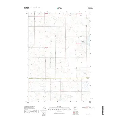
2020 Map of Liens Dams
USGS Topo · Published 2020About this map
Chanta Peta Cr and its tributaries wind through this section of the High Plains, where the border of Hettinger and Adams counties divides a landscape of section-line roads and prairie drainages. The local hydrology is anchored by Liens Dams in the northeastern portion of the quadrangle, with water moving through Indian Creek and Tepee Cr. A network of rural routes, including Havelock Rd and the specifically named Three Mile Bridge Rd, provides the primary infrastructure for this ranching and agricultural region. The mapping reveals the systematic township and range organization of the Dakotas, showing how transportation routes like Indian Cr Dam Rd and various numbered avenues follow the rigid geometry of the public land survey system across the undulating terrain.
Find a feature on this map
32 named features on this map. Tap any name to fly to it.
Don’t see what you’re looking for? This feature index may not catch every label — zoom into the map to look around manually.
Map Details
Editions of this 2020 Liens Dams Map
This is the sole edition of this map. No revisions or reprints were ever made.
Other maps of this area

1953 · Dickinson
USGS Topo · 1:250,000

1957 · Dickinson
USGS Topo · 1:250,000

1966 · Regent
USGS Topo · 1:24,000

1973 · Liens Dams
USGS Topo · 1:24,000

1973 · Jung Lake
USGS Topo · 1:24,000

1973 · Havelock
USGS Topo · 1:24,000

1973 · Enterprise School
USGS Topo · 1:24,000

1973 · Abbey Hill
USGS Topo · 1:24,000

1980 · Mott
USGS Topo · 1:100,000
2011 · Enterprise School
USGS Topo · 1:24,000