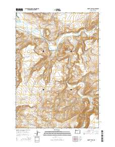
2014 Map of Liggett Table
USGS Topo · Published 2014About this map
Liggett Table dominates the high ground in this section of Crook County, providing a clear look at the drainage patterns and high-desert terrain of central Oregon. The Crooked River enters the frame from the north, eventually meeting its southern counterpart, the S Fork Crooked River, amidst a landscape defined by sharp elevation changes like Hawk Rim. Transportation through this isolated region is anchored by the SE Paulina Hwy and Or-380, which follow the natural contours of the river valleys. This 2014 survey documents the remote character of the area, where water sources like Kelly Cr dictate the layout of the land across multiple township and range sections. The map serves as a primary record of the topographic features and modern road networks in a sparsely populated but geographically distinct part of the state.
Find a feature on this map
11 named features on this map. Tap any name to fly to it.
Don’t see what you’re looking for? This feature index may not catch every label — zoom into the map to look around manually.
Map Details
Editions of this 2014 Liggett Table Map
This is the sole edition of this map. No revisions or reprints were ever made.
Other maps of this area

1932 · Dayville
USGS Topo · 1:125,000

1936 · Dayville
USGS Topo · 1:125,000

1955 · Crescent
USGS Topo · 1:250,000

1955 · Bend
USGS Topo · 1:250,000

1955 · Burns
USGS Topo · 1:250,000

1955 · Canyon City
USGS Topo · 1:250,000

1957 · Crescent
USGS Topo · 1:250,000

1957 · Bend
USGS Topo · 1:250,000

1958 · Crescent
USGS Topo · 1:250,000

1958 · Burns
USGS Topo · 1:250,000