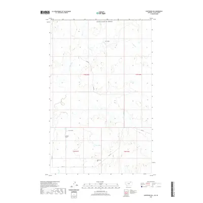
2020 Map of Lighthouse Hill
USGS Topo · Published 2020About this map
Lighthouse Hill stands as a prominent topographical marker in this section of Valley County, where the high plains are carved by an intricate network of drainage channels. The landscape is defined by the repetitive rhythm of coulees, including Line Coulee in the north and the nearby First Coulee and Chambers Coulee to the south. Water is scarce in this arid environment, making features like Lake Elbert and the seasonal flows of Rock Creek and Horse Cr critical points of interest for historical land use. A handful of section-line roads, such as Fossum Rd and Theony Rd, provide the only modern access through this sparsely populated ranching country, following the natural contours of the northern Montana prairie.
Find a feature on this map
17 named features on this map. Tap any name to fly to it.
Don’t see what you’re looking for? This feature index may not catch every label — zoom into the map to look around manually.
Map Details
Editions of this 2020 Lighthouse Hill Map
This is the sole edition of this map. No revisions or reprints were ever made.
Other maps of this area

1919 · Boundary
USGS Topo · 1:125,000

1954 · Glasgow
USGS Topo · 1:250,000

1957 · Glasgow
USGS Topo · 1:250,000

1958 · Glasgow
USGS Topo · 1:250,000

1984 · Lighthouse Hill
USGS Topo · 1:24,000

1984 · Opheim
USGS Topo · 1:100,000

1984 · Dodge Reservoir
USGS Topo · 1:24,000

1984 · Last Chance Reservoir
USGS Topo · 1:24,000
1984 · Coal Mine Creek West
USGS Topo · 1:24,000
1984 · Thoeny
USGS Topo · 1:24,000