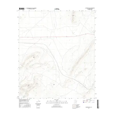
2016 Map of Lightning Hills
USGS Topo · Published 2016About this map
Stillwell Mtn and the Warwick Hills define the high elevations of this Brewster County landscape, where water sources were critical for survival. The drainage of San Francisco Cr cuts through the center of the sheet, joined by smaller tributaries like Frog Cr and Willow Cr. Evidence of vital water access is found at the base of the southwestern peaks, where Peña Blanca Spring and Blanca Spring are located. The presence of these named springs suggests their importance for early livestock ranching in this arid region. Most of the terrain is characterized by deep erosional features like Arden Draw, while the Lightning Hills rise prominently to the south. This environment reflects the character of the Big Bend country, where geography is dictated by seasonal watercourses and the stark topography of the Texas interior.
Find a feature on this map
10 named features on this map. Tap any name to fly to it.
Don’t see what you’re looking for? This feature index may not catch every label — zoom into the map to look around manually.
Map Details
Editions of this 2016 Lightning Hills Map
This is the sole edition of this map. No revisions or reprints were ever made.
Other maps of this area

1920 · Longfellow
USGS Topo · 1:125,000

1920 · Marathon
USGS Topo · 1:62,500

1921 · Marathon
USGS Topo · 1:62,500

1923 · Hess Canyon
USGS Topo · 1:62,500

1954 · Fort Stockton
USGS Topo · 1:250,000

1958 · Fort Stockton
USGS Topo · 1:250,000
1967 · Horse Mountain
USGS Topo · 1:24,000

1968 · Housetop Mountains
USGS Topo · 1:24,000

1968 · Tesnus
USGS Topo · 1:24,000

1968 · Dimple Hills
USGS Topo · 1:24,000