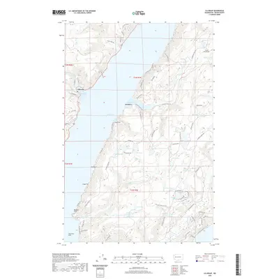
2020 Map of Lilliwaup
USGS Topo · Published 2020About this map
Hood Canal serves as the central focal point for this maritime landscape, dividing the western shore at Lilliwaup from the Dewatto community on the Great Peninsula. The western edge is defined by the steep drainage of Lilliwaup Cr, which features the notable Lilliwaup Falls before emptying into Lilliwaup Bay. Across the water, the terrain is dotted with a high density of small lakes and wetlands, including Maggie Lake, Wildberry Lake, and The Peat Bog.
Find a feature on this map
79 named features on this map. Tap any name to fly to it.
Don’t see what you’re looking for? This feature index may not catch every label — zoom into the map to look around manually.
Map Details
Editions of this 2020 Lilliwaup Map
This is the sole edition of this map. No revisions or reprints were ever made.
Other maps of this area

1936 · Point Misery
USGS Topo · 1:62,500

1938 · Mt Constance
USGS Topo · 1:125,000

1938 · Allyn
USGS Topo · 1:62,500

1940 · Point Misery
USGS Topo · 1:62,500

1943 · Potlatch
USGS Topo · 1:62,500

1947 · The Brothers
USGS Topo · 1:62,500

1950 · The Brothers
USGS Topo · 1:62,500

1952 · Potlatch
USGS Topo · 1:62,500

1953 · Lake Wooten
USGS Topo · 1:24,000
1953 · Holly
USGS Topo · 1:24,000