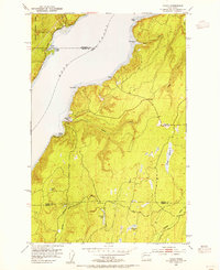
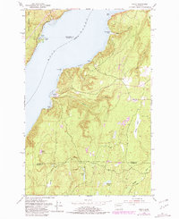
1953 Map of Holly
USGS Topo · Published 1955About this map
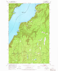
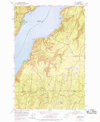
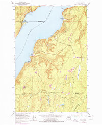
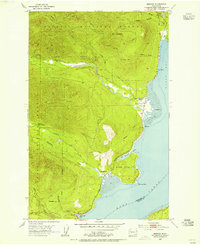
The waters of Hood Canal define the western shoreline of this Kitsap Peninsula landscape, where small waterfront settlements like Holly and Nellita are reached by winding forest roads. The interior is characterized by dense drainage networks and numerous small bodies of water, including Erickson Lake, Blacksmith Lake, and the expansive Morgan Marsh. To the south, the headwaters of the Dewatto River and Tahuya River carve through the terrain, with the latter passing through Elfendhal Pass. This mid-century survey illustrates the rural character of the region before significant modern development, showing the transition from the eastern edge of the Olympic National Forest near Triton Cove across the county lines of Jefferson, Mason, and Kitsap. Notable landmarks such as Triton Head and Tekiu Point provide clear navigational markers along the canal's rugged coastline.
Find a feature on this map
26 named features on this map. Tap any name to fly to it.
Don’t see what you’re looking for? This feature index may not catch every label — zoom into the map to look around manually.
Map Details
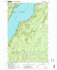
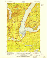
Editions of this 1953 Holly Map
6 editions found
Other maps of this area

1936 · Point Misery
USGS Topo · 1:62,500

1938 · Mt Constance
USGS Topo · 1:125,000

1938 · Allyn
USGS Topo · 1:62,500

1940 · Point Misery
USGS Topo · 1:62,500

1943 · Potlatch
USGS Topo · 1:62,500

1947 · The Brothers
USGS Topo · 1:62,500

1950 · The Brothers
USGS Topo · 1:62,500
1952 · Potlatch
USGS Topo · 1:62,500
1953 · Seabeck
USGS Topo · 1:24,000
1953 · Brinnon
USGS Topo · 1:24,000