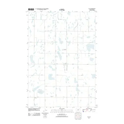
2012 Map of Lily
USGS Topo · Published 2012About this map
Glacial prairie potholes and scattered water bodies define this portion of Day County as it appeared in 2012. The landscape is structured by a strict section-line road grid, including 425th Ave and 150th St, which navigate between prominent basins like Horseshoe Lake and Cottonwood Lake. The map reveals a dispersed rural community where life is anchored by local institutions such as Hillside Cem and Saint Joseph's Catholic Cem. Small clusters of development appear along Elm St and Hazelton Ave, providing specific coordinates for genealogical research in this sparsely populated area. The presence of both Our Saviors Cem and West Saviors Cem suggests the historical locations of denominational congregations that served the surrounding farmsteads.
Find a feature on this map
25 named features on this map. Tap any name to fly to it.
Don’t see what you’re looking for? This feature index may not catch every label — zoom into the map to look around manually.
Map Details
Editions of this 2012 Lily Map
This is the sole edition of this map. No revisions or reprints were ever made.
Other maps of this area

1953 · Milbank
USGS Topo · 1:250,000

1958 · Milbank
USGS Topo · 1:250,000

1973 · Lily
USGS Topo · 1:24,000

1973 · Webster
USGS Topo · 1:24,000

1973 · Bristol West
USGS Topo · 1:24,000

1973 · Swan Lake
USGS Topo · 1:24,000

1973 · Bradley
USGS Topo · 1:24,000

1973 · Lone Tree Lake
USGS Topo · 1:24,000

1973 · Bristol East
USGS Topo · 1:24,000

1973 · Heggs Lake
USGS Topo · 1:24,000