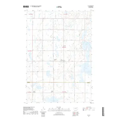
2017 Map of Lily
USGS Topo · Published 2017About this map
Lily sits at the heart of this prairie landscape, a small settlement located along the high glacial plateau of the Coteau des Prairies. The surrounding terrain in this 2017 study is characterized by a dense network of wetlands and prominent water bodies such as Horseshoe Lake and Long Lake. The map reveals a high concentration of sites important for local genealogy and history, including Hillside Cem and Saint Joseph's Catholic Cem near the town center. To the south, across the border of Day and Clark Counties, the map identifies the distinct locations of Our Saviors Lutheran West Cem and Our Saviors Lutheran East Cem, along with Cottonwood Lake. The rigid grid of section lines and gravel roads, like Co Rd 36 and Co Rd 29, provides the framework for these scattered rural landmarks and agricultural tracts.
Find a feature on this map
41 named features on this map. Tap any name to fly to it.
Don’t see what you’re looking for? This feature index may not catch every label — zoom into the map to look around manually.
Map Details
Editions of this 2017 Lily Map
This is the sole edition of this map. No revisions or reprints were ever made.
Other maps of this area

1953 · Milbank
USGS Topo · 1:250,000

1958 · Milbank
USGS Topo · 1:250,000

1973 · Lily
USGS Topo · 1:24,000

1973 · Webster
USGS Topo · 1:24,000

1973 · Bristol West
USGS Topo · 1:24,000

1973 · Swan Lake
USGS Topo · 1:24,000

1973 · Bradley
USGS Topo · 1:24,000

1973 · Lone Tree Lake
USGS Topo · 1:24,000

1973 · Bristol East
USGS Topo · 1:24,000

1973 · Heggs Lake
USGS Topo · 1:24,000