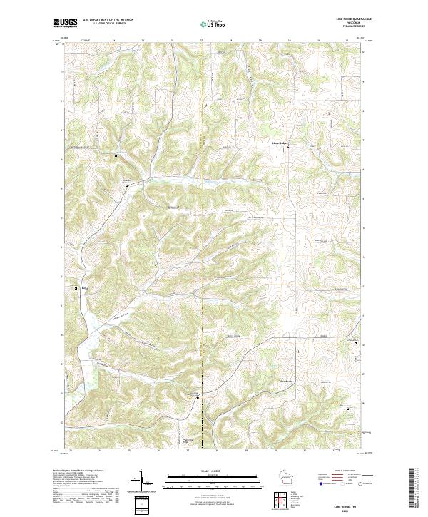
2022 Map of Lime Ridge
USGS Topo · Published 2022About this map
The border of Richland and Sauk Counties defines this part of the Driftless Area, where the village of Lime Ridge sits atop the high ground. The landscape is characterized by a series of narrow drainages and ridges, with Willow Creek and Bear Creek cutting through the local valleys. This terrain is mirrored in the naming of several deep hollows, including Smith Hollow, Robin Hollow, and Lost Hollow, which have historically dictated the placement of rural roads and homesteads.
Find a feature on this map
55 named features on this map. Tap any name to fly to it.
Don’t see what you’re looking for? This feature index may not catch every label — zoom into the map to look around manually.
Map Details
Editions of this 2022 Lime Ridge Map
This is the sole edition of this map. No revisions or reprints were ever made.
Other maps of this area

1905 · Richland Center
USGS Topo · 1:125,000

1927 · Hillsboro
USGS Topo · 1:62,500

1956 · Reedsburg
USGS Topo · 1:62,500

1958 · La Crosse
USGS Topo · 1:250,000

1960 · Richland Center
USGS Topo · 1:62,500

1960 · Plain
USGS Topo · 1:62,500

1961 · La Crosse
USGS Topo · 1:250,000

1965 · La Crosse
USGS Topo · 1:250,000

1966 · Hillsboro
USGS Topo · 1:62,500
1975 · Reedsburg West
USGS Topo · 1:24,000