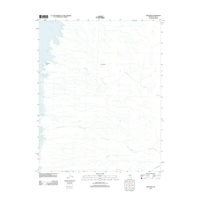
2012 Map of Lime Wash
USGS Topo · Published 2012About this map
Lake Mead defines the western edge of this desert landscape, where the reservoir shoreline is broken by numerous inlets such as Cottonwood Cove, Preachers Cove, and Quail Bay. The topography is dominated by an intricate drainage system, with Lime Wash and Quail Springs Wash carving deep paths through the arid terrain toward the lake. This 2012 survey illustrates the remote character of Clark County, where water sources like Quail Spring, Mockingbird Spring, and Maynard Spring remain critical landmarks. The presence of Scanlon Ferry Rd in the southeast corner provides a trace of historical transit through the region. Significant geological features, including Lime Canyon and Submarine Point, stand as prominent markers above the water line. The map also identifies several distinct shore features with idiosyncratic names such as Glory Hole, Kline Hole, and Weasel Hole, reflecting the localized nomenclature of the Lake Mead shoreline.
Find a feature on this map
18 named features on this map. Tap any name to fly to it.
Don’t see what you’re looking for? This feature index may not catch every label — zoom into the map to look around manually.
Map Details
Editions of this 2012 Lime Wash Map
This is the sole edition of this map. No revisions or reprints were ever made.
Other maps of this area

1886 · Saint Thomas
USGS Topo · 1:250,000

1893 · Saint Thomas
USGS Topo · 1:250,000

1926 · Bonelli
USGS Topo · 1:96,000

1953 · Overton Beach
USGS Topo · 1:62,500

1953 · Iceberg Canyon
USGS Topo · 1:62,500

1953 · Gold Butte
USGS Topo · 1:62,500

1953 · Virgin Basin
USGS Topo · 1:62,500

1954 · Las Vegas
USGS Topo · 1:250,000

1957 · Las Vegas
USGS Topo · 1:250,000

1959 · Las Vegas
USGS Topo · 1:250,000