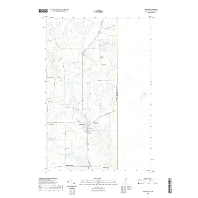
2021 Map of Limestone
USGS Topo · Published 2021About this map
Limestone serves as the central hub of this Aroostook County landscape, positioned along the international boundary between the United States of America and Canada. The settlement pattern is defined by traditional agricultural intersections like Grass Corner, Cote Corner, and Four Corners, reflecting a rural economy tied to the land. The presence of numerous small burying grounds, including the Howland Family Cem, Webster Cem, and Peers Cem, provides essential documentation for genealogists tracing local lineage in this border region.
Find a feature on this map
62 named features on this map. Tap any name to fly to it.
Don’t see what you’re looking for? This feature index may not catch every label — zoom into the map to look around manually.
Map Details
Editions of this 2021 Limestone Map
This is the sole edition of this map. No revisions or reprints were ever made.
Other maps of this area

1921 · Van Buren
USGS Topo · 1:250,000

1930 · Fort Fairfield
USGS Topo · 1:48,000

1931 · Van Buren
USGS Topo · 1:48,000

1933 · Fort Fairfield
USGS Topo · 1:62,500

1934 · Van Buren
USGS Topo · 1:62,500

1951 · Van Buren
USGS Topo · 1:62,500

1951 · Fort Fairfield
USGS Topo · 1:62,500

1953 · Fort Fairfield NW
USGS Topo · 1:24,000
1953 · Limestone
USGS Topo · 1:24,000

1959 · Woodstock
USGS Topo · 1:250,000