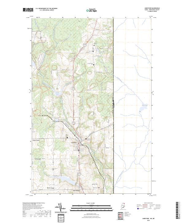
2024 Map of Limestone
USGS Topo · Published 2024About this map
Limestone serves as the central hub of this northern Maine landscape, where the agricultural traditions of Aroostook County meet the international border with the United States of America Canada. The terrain is defined by a dense network of waterways including Limestone Stream, Durepo Pond, and Silver Spring Brook, which historically supported the region's potato-farming economy. To the northwest, the Aroostook National Wildlife Refuge preserves a significant portion of the former Loring Air Force Base lands, including recreational paths like the Beaver Pond Trail and Don Lima Trail. Family history is deeply rooted in the landscape, evidenced by numerous small burial grounds such as the Howland Family Cem and Kenneson Cem near Kennison Hill. The map traces a series of rural crossroads like Grass Corner, Cote Corner, and Four Corners, illustrating the enduring settlement patterns of this borderland community.
Find a feature on this map
64 named features on this map. Tap any name to fly to it.
Don’t see what you’re looking for? This feature index may not catch every label — zoom into the map to look around manually.
Map Details
Editions of this 2024 Limestone Map
This is the sole edition of this map. No revisions or reprints were ever made.
Other maps of this area

1921 · Van Buren
USGS Topo · 1:250,000

1930 · Fort Fairfield
USGS Topo · 1:48,000

1931 · Van Buren
USGS Topo · 1:48,000

1933 · Fort Fairfield
USGS Topo · 1:62,500

1934 · Van Buren
USGS Topo · 1:62,500

1951 · Van Buren
USGS Topo · 1:62,500

1951 · Fort Fairfield
USGS Topo · 1:62,500

1953 · Fort Fairfield NW
USGS Topo · 1:24,000
1953 · Limestone
USGS Topo · 1:24,000

1959 · Woodstock
USGS Topo · 1:250,000