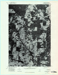
1975 Map of Limestone
USGS Topo · Published 1981About this map
Limestone and its surrounding potato-farming landscape define this 1975 orthophotoquad, which uses rectified aerial imagery to show the intense agricultural patchwork of northern Aroostook County. The map captures a unique cross-border perspective, clearly marking the United States Canada boundary and the transition into Maine New Brunswick. This aerial view reveals the dense network of rural roads connecting small residential clusters and agricultural outposts like Gillespie Settlement and Upper California. The course of Limestone Stream winds through the village center, providing a natural anchor for the local geography. Local family names and small intersections are preserved in labels for Mc Cluskey, Morris Corner, and Four Corners, offering researchers a precise look at property layout and land use before late-century development changed the rural footprint.
Find a feature on this map
11 named features on this map. Tap any name to fly to it.
Don’t see what you’re looking for? This feature index may not catch every label — zoom into the map to look around manually.
Map Details
Editions of this 1975 Limestone Map
This is the sole edition of this map. No revisions or reprints were ever made.
Other maps of this area

1921 · Van Buren
USGS Topo · 1:250,000

1930 · Fort Fairfield
USGS Topo · 1:48,000

1931 · Van Buren
USGS Topo · 1:48,000

1933 · Fort Fairfield
USGS Topo · 1:62,500

1934 · Van Buren
USGS Topo · 1:62,500

1951 · Van Buren
USGS Topo · 1:62,500

1951 · Fort Fairfield
USGS Topo · 1:62,500

1953 · Fort Fairfield NW
USGS Topo · 1:24,000
1953 · Limestone
USGS Topo · 1:24,000

1959 · Woodstock
USGS Topo · 1:250,000