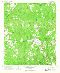
1965 Map of Limestone
USGS Topo · Published 1967About this map
Sumter National Forest dominates the landscape of this mid-1960s survey, where the dense timber of South Carolina's piedmont is punctuated by a series of long-standing rural crossroads. The settlement of Limestone serves as a central point in a territory defined by its complex drainage network, including Cuffytown Creek and Turkey Creek. The map documents a significant network of historic travel routes like Martintown Road and Five Notch Road, which historically linked these upland communities. Local life is centered around numerous country churches such as Springfield Ch and Gilgal Ch, along with family-named landmarks like Penn Cem. The convergence of five county lines—Greenwood, McCormick, Edgefield, Saluda, and McCormick—near Mayson Crossroads reveals the intricate political geography of the region before modern highway development further altered these rural patterns.
Find a feature on this map
63 named features on this map. Tap any name to fly to it.
Don’t see what you’re looking for? This feature index may not catch every label — zoom into the map to look around manually.
Map Details
Editions of this 1965 Limestone Map
This is the sole edition of this map. No revisions or reprints were ever made.
Other maps of this area

1892 · Mc Cormick
USGS Topo · 1:125,000

1892 · Abbeville
USGS Topo · 1:125,000

1908 · Kirksey
USGS Topo · 1:24,000

1912 · Mc Cormick
USGS Topo · 1:125,000

1941 · Spartanburg
USGS Topo · 1:250,000

1950 · Bradley
USGS Topo · 1:24,000

1950 · Kirksey
USGS Topo · 1:24,000

1953 · Athens
USGS Topo · 1:250,000

1953 · Spartanburg
USGS Topo · 1:250,000

1954 · Augusta
USGS Topo · 1:250,000