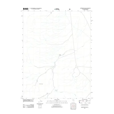
2012 Map of Limestone Peak
USGS Topo · Published 2012About this map
Limestone Peak dominates this high-elevation landscape in White Pine County, a region characterized by dramatic drainage patterns and sparse water sources. The map trace reveals the complex geography of Hayden Canyon and the winding course of Hayden Cr as it descends through the terrain. Evidence of water management and local geography is central to the area's layout, seen in the placement of Circle Wash Reservoir and the seasonal flow of Circle Wash. Remote outposts like Butte Spring highlight the critical role of isolated water points in this arid part of Nevada. This survey documents the intersection of natural topography and limited human infrastructure in the Great Basin, focusing on the essential water features that define the territory.
Find a feature on this map
6 named features on this map. Tap any name to fly to it.
Don’t see what you’re looking for? This feature index may not catch every label — zoom into the map to look around manually.
Map Details
Editions of this 2012 Limestone Peak Map
This is the sole edition of this map. No revisions or reprints were ever made.
Other maps of this area

1949 · Treasure Hill
USGS Topo · 1:62,500

1950 · Treasure Hill
USGS Topo · 1:62,500

1951 · Illipah
USGS Topo · 1:62,500

1956 · Ely
USGS Topo · 1:250,000

1959 · Ely
USGS Topo · 1:250,000

1959 · Reipetown
USGS Topo · 1:62,500

1959 · Preston Reservoir
USGS Topo · 1:62,500

1963 · Ely
USGS Topo · 1:250,000

1979 · Mt. Hamilton
USGS Topo · 1:100,000
1990 · Treasure Hill
USGS Topo · 1:24,000