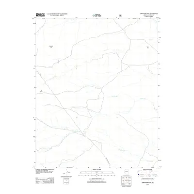
2012 Map of Limestone Peak
USGS Topo · Published 2012About this map
Limestone Peak dominates this drainage basin in central Arizona, marking a landscape defined by an intricate network of seasonal washes and high-altitude passes. This topographic study reveals the importance of water management and transit in the arid environment, where features like Sampson Tank and The Sinks indicate localized geological formations and vital water catchment points. The terrain is bisected by the historic Aztec Pass, a natural corridor between high ground that has long served as a passage through the region's complex topography. Multiple watercourses, including Walnut Cr, Quartz Lead Wash, and Antelope Wash, converge toward the southwest, illustrating the natural watershed patterns. Human presence is noted through the run of N Williamson Valley Rd, which follows the contours of the land through the lower elevations near Mud Tank Wash and Indian Springs Wash.
Find a feature on this map
11 named features on this map. Tap any name to fly to it.
Don’t see what you’re looking for? This feature index may not catch every label — zoom into the map to look around manually.
Map Details
Editions of this 2012 Limestone Peak Map
This is the sole edition of this map. No revisions or reprints were ever made.
Other maps of this area

1886 · Chino
USGS Topo · 1:250,000

1887 · Prescott
USGS Topo · 1:250,000

1891 · Chino
USGS Topo · 1:250,000

1892 · Prescott
USGS Topo · 1:250,000

1947 · Simmons
USGS Topo · 1:62,500

1947 · Picacho Butte
USGS Topo · 1:62,500

1947 · Turkey Canyon
USGS Topo · 1:62,500

1947 · Camp Wood
USGS Topo · 1:62,500

1948 · Williams
USGS Topo · 1:250,000

1948 · Picacho Butte
USGS Topo · 1:63,360