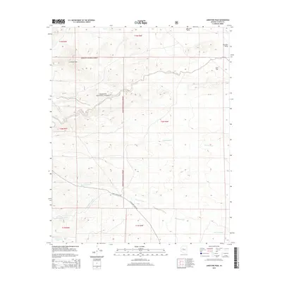
2014 Map of Limestone Peak
USGS Topo · Published 2014About this map
Limestone Peak and the high desert terrain of the Prescott National Forest dominate this 2014 survey of central Arizona. The landscape is defined by its complex drainage network, where ephemeral channels like Walnut Creek, Antelope Wash, and Mud Tank Wash carve through the foothills of the Big Chino Valley. These washes represent the critical seasonal water movement across the region, while landmarks such as Aztec Pass indicate the natural corridors used for navigation through the mountainous terrain. Infrastructure is sparse, concentrated primarily on secondary routes like N Williamson Valley Rd and Forest Service 6 Rd, which provide access to ranching or forest management areas. For those interested in land use and geography, the presence of localized features such as Sampson Tank and Quartz Lead Wash highlights the traditional importance of water collection and mining-related exploration in this part of Yavapai County.
Find a feature on this map
19 named features on this map. Tap any name to fly to it.
Don’t see what you’re looking for? This feature index may not catch every label — zoom into the map to look around manually.
Map Details
Editions of this 2014 Limestone Peak Map
This is the sole edition of this map. No revisions or reprints were ever made.
Other maps of this area

1886 · Chino
USGS Topo · 1:250,000

1887 · Prescott
USGS Topo · 1:250,000

1891 · Chino
USGS Topo · 1:250,000

1892 · Prescott
USGS Topo · 1:250,000

1947 · Simmons
USGS Topo · 1:62,500

1947 · Picacho Butte
USGS Topo · 1:62,500

1947 · Turkey Canyon
USGS Topo · 1:62,500

1947 · Camp Wood
USGS Topo · 1:62,500

1948 · Williams
USGS Topo · 1:250,000

1948 · Picacho Butte
USGS Topo · 1:63,360