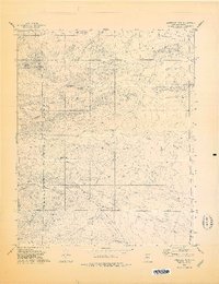
1978 Map of Limestone Peak
USGS Topo · Published 1978About this map
Prescott National Forest dominates the western half of this 1970s landscape, where the rugged terrain of Limestone Peak gives way to the open reaches of the Chino Valley. This survey, updated just before the late 20th-century growth in the region, reveals a sparse ranching and grazing environment defined by its water sources. Essential infrastructure for local land use is marked by numerous named water points including Fritsche Well, Quartz Well, and Indian Well. Drainage patterns are clearly delineated through the winding courses of Walnut Creek, Antelope Wash, and Quartz Lead Wash. A single Jeep Trail provides one of the few managed routes through this arid section of Yavapai County, highlighting the isolation of the area during this period of the late 1970s.
Find a feature on this map
15 named features on this map. Tap any name to fly to it.
Don’t see what you’re looking for? This feature index may not catch every label — zoom into the map to look around manually.
Map Details
Editions of this 1978 Limestone Peak Map
This is the sole edition of this map. No revisions or reprints were ever made.
Other maps of this area

1886 · Chino
USGS Topo · 1:250,000

1887 · Prescott
USGS Topo · 1:250,000

1891 · Chino
USGS Topo · 1:250,000

1892 · Prescott
USGS Topo · 1:250,000

1947 · Simmons
USGS Topo · 1:62,500

1947 · Picacho Butte
USGS Topo · 1:62,500

1947 · Turkey Canyon
USGS Topo · 1:62,500

1947 · Camp Wood
USGS Topo · 1:62,500

1948 · Williams
USGS Topo · 1:250,000

1948 · Picacho Butte
USGS Topo · 1:63,360