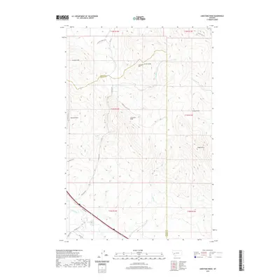
2020 Map of Limestone Ridge
USGS Topo · Published 2020About this map
Limestone Ridge and the Garnet Range dominate this 2020 landscape along the border of Granite and Powell Counties. The terrain is defined by a series of prominent peaks and gulches, including Campbell Mtn and Sturgeon Mtn, which overlook a network of high-altitude drainages such as Sturgeon Cr and Elk Swamp Cr. In the southern portion of the map, the landscape descends toward the valley of the Clark Fork river, where transportation corridors like Helmville Rd and Frontage Rd E parallel the water. The map traces several specialized routes such as Saddle Mt Lookout Rd and Mullin Trl, which navigate the steep elevations near Saddle Mt. This survey illustrates the modern configuration of mountain access roads and remote ridges in a region primarily shaped by its high-country topography and river access.
Find a feature on this map
32 named features on this map. Tap any name to fly to it.
Don’t see what you’re looking for? This feature index may not catch every label — zoom into the map to look around manually.
Map Details
Editions of this 2020 Limestone Ridge Map
This is the sole edition of this map. No revisions or reprints were ever made.
Other maps of this area

1889 · Helena
USGS Topo · 1:250,000

1893 · Helena
USGS Topo · 1:250,000

1899 · Helena
USGS Topo · 1:250,000

1903 · Helena
USGS Topo · 1:250,000

1919 · Drummond
USGS Topo · 1:125,000

1921 · Drummond
USGS Topo · 1:125,000

1947 · Butte
USGS Topo · 1:250,000

1958 · Butte
USGS Topo · 1:250,000

1958 · Drummond
USGS Topo · 1:62,500

1958 · Garrison
USGS Topo · 1:62,500