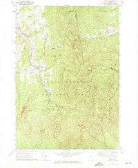
1970 Map of Lincoln
USGS Topo · Published 1972About this map
The high ridges of the Green Mountain National Forest dominate this 1970s topographic record, where the spine of the Green Mountains dictates the local geography and transport. The Long Trail traverses the eastern summits, connecting notable peaks such as Mt Abraham, Mt Roosevelt, and Mt Wilson. These summits are punctuated by wilderness landmarks like the Battell Shelter and Cooley Glen Shelter, providing key references for regional hikers and backcountry historians. In the valleys, the New Haven River and its numerous tributaries, including Beaver Meadow Brook and Battell Brook, carve the landscape toward the western settlements.
Find a feature on this map
43 named features on this map. Tap any name to fly to it.
Don’t see what you’re looking for? This feature index may not catch every label — zoom into the map to look around manually.
Map Details
Editions of this 1970 Lincoln Map
2 editions found
Other maps of this area

1902 · Brandon
USGS Topo · 1:62,500

1903 · Middlebury
USGS Topo · 1:62,500

1904 · Brandon
USGS Topo · 1:62,500

1905 · Middlebury
USGS Topo · 1:62,500

1915 · Rochester
USGS Topo · 1:62,500

1917 · Rochester
USGS Topo · 1:62,500

1919 · Lincoln Mountain
USGS Topo · 1:62,500

1920 · Lincoln Mountain
USGS Topo · 1:48,000

1920 · Brandon
USGS Topo · 1:62,500

1920 · Middlebury
USGS Topo · 1:62,500