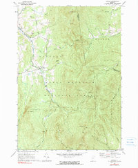
1970 Map of Lincoln
USGS Topo · Published 1990About this map
The New Haven River carves a deep valley through the heart of the Green Mountain National Forest, serving as the primary corridor for settlement in this part of Vermont. The town of Lincoln and the smaller community of South Lincoln are situated along its banks, where the terrain relents just enough to allow for small-scale agriculture and industry. Topographic detail from 1970 reveals a landscape defined by sharp elevation changes, anchored by high peaks like Mt Abraham and Bread Loaf Mountain. For hikers and local historians, the map traces the legendary Long Trail as it follows the ridge line through Lincoln Gap, supported by primitive waypoints such as Battell Shelter and Emily Proctor Shelter. The presence of numerous Gravel Pits and the Lincoln Community Sch reflects the ongoing local utility and communal life within this heavily forested, mountainous geography.
Find a feature on this map
43 named features on this map. Tap any name to fly to it.
Don’t see what you’re looking for? This feature index may not catch every label — zoom into the map to look around manually.
Map Details
Editions of this 1970 Lincoln Map
2 editions found
Other maps of this area

1902 · Brandon
USGS Topo · 1:62,500

1903 · Middlebury
USGS Topo · 1:62,500

1904 · Brandon
USGS Topo · 1:62,500

1905 · Middlebury
USGS Topo · 1:62,500

1915 · Rochester
USGS Topo · 1:62,500

1917 · Rochester
USGS Topo · 1:62,500

1919 · Lincoln Mountain
USGS Topo · 1:62,500

1920 · Lincoln Mountain
USGS Topo · 1:48,000

1920 · Brandon
USGS Topo · 1:62,500

1920 · Middlebury
USGS Topo · 1:62,500