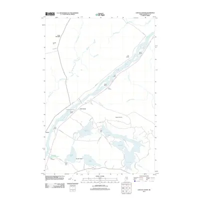
2011 Map of Lincoln Center
USGS Topo · Published 2011About this map
The Penobscot River serves as the central artery of this landscape, its waters divided by islands such as Brown Islands, Snow Island, and Hersey Island. Along its eastern banks, the communities of Lincoln Center and North Lincoln are well-established, while the town of Chester sits on the western shore. The area’s water management history is visible through a series of local structures including the Long Pond Dam, Mill Pond Dam, and the evocatively named Snag Pond Dam.
Find a feature on this map
53 named features on this map. Tap any name to fly to it.
Don’t see what you’re looking for? This feature index may not catch every label — zoom into the map to look around manually.
Map Details
Editions of this 2011 Lincoln Center Map
This is the sole edition of this map. No revisions or reprints were ever made.
Other maps of this area

1920 · Winn
USGS Topo · 1:62,500

1940 · Mattawamkeag
USGS Topo · 1:62,500

1942 · Lincoln
USGS Topo · 1:62,500

1942 · Mattawamkeag
USGS Topo · 1:62,500

1951 · Millinocket
USGS Topo · 1:62,500

1954 · Millinocket
USGS Topo · 1:250,000

1957 · Lincoln
USGS Topo · 1:62,500

1958 · Millinocket
USGS Topo · 1:250,000

1960 · Millinocket
USGS Topo · 1:250,000
1960 · Winn
USGS Topo · 1:62,500