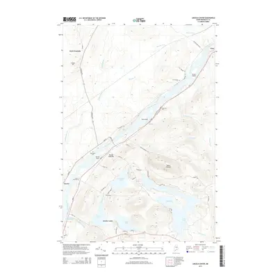
2014 Map of Lincoln Center
USGS Topo · Published 2014About this map
The Penobscot River serves as the central artery for this region of Penobscot County, where the river's path is marked by islands and rapids. Settlements like North Lincoln and Lincoln Center are established along the eastern banks, following the corridor of Us-2. This transportation route parallels the historical path of the Old Military Rd, reflecting the area's development as a river-based economy transitioning to modern highway transit. The landscape is dotted with small cemeteries including Snow Cem, Mid Chester Cem, and Lincoln Center Cem, which provide specific points of interest for genealogists tracking early families in the Chester and Lincoln areas.
Find a feature on this map
59 named features on this map. Tap any name to fly to it.
Don’t see what you’re looking for? This feature index may not catch every label — zoom into the map to look around manually.
Map Details
Editions of this 2014 Lincoln Center Map
This is the sole edition of this map. No revisions or reprints were ever made.
Other maps of this area

1920 · Winn
USGS Topo · 1:62,500

1940 · Mattawamkeag
USGS Topo · 1:62,500

1942 · Lincoln
USGS Topo · 1:62,500

1942 · Mattawamkeag
USGS Topo · 1:62,500

1951 · Millinocket
USGS Topo · 1:62,500

1954 · Millinocket
USGS Topo · 1:250,000

1957 · Lincoln
USGS Topo · 1:62,500

1958 · Millinocket
USGS Topo · 1:250,000

1960 · Millinocket
USGS Topo · 1:250,000
1960 · Winn
USGS Topo · 1:62,500