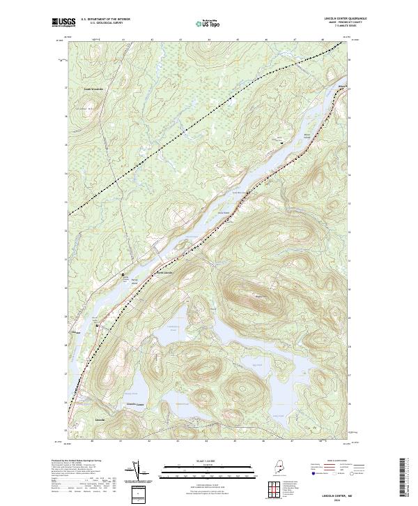
2024 Map of Lincoln Center
USGS Topo · Published 2024About this map
The Penobscot River carves a deep valley through this region, shaping the development of riverside settlements like Lincoln Center, North Lincoln, and Chester. This area is defined by its significant water bodies, including the Cambolasse Pond and Center Pond, which are interconnected by complex drainage systems like the Cambolasse Stream Reservoir. The landscape is notably punctuated by numerous family and community burial grounds, such as Snow Cem and Middle Chester Cem, which offer significant value for genealogical research in Penobscot County.
Find a feature on this map
59 named features on this map. Tap any name to fly to it.
Don’t see what you’re looking for? This feature index may not catch every label — zoom into the map to look around manually.
Map Details
Editions of this 2024 Lincoln Center Map
This is the sole edition of this map. No revisions or reprints were ever made.
Other maps of this area

1920 · Winn
USGS Topo · 1:62,500

1940 · Mattawamkeag
USGS Topo · 1:62,500

1942 · Lincoln
USGS Topo · 1:62,500

1942 · Mattawamkeag
USGS Topo · 1:62,500

1951 · Millinocket
USGS Topo · 1:62,500

1954 · Millinocket
USGS Topo · 1:250,000

1957 · Lincoln
USGS Topo · 1:62,500

1958 · Millinocket
USGS Topo · 1:250,000

1960 · Millinocket
USGS Topo · 1:250,000
1960 · Winn
USGS Topo · 1:62,500