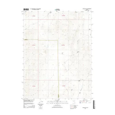
2014 Map of Lincoln Flat
USGS Topo · Published 2014About this map
Lincoln Flat and the surrounding high desert of the Singatse Range define this portion of the western Great Basin. The landscape is marked by geological crossings and corridors, most notably Gallagher Pass and Mason Pass, which historically facilitated movement between the interior basins and the agricultural lands of Mason Valley. To the south, Wishart Hill rises near the junction of mountain and valley floor, while Churchill Canyon and Blackrock anchor the northern reaches of the quadrangle. The sparse road network, including Julian Ln and Mason Pass Rd, follows the natural contours of the land, tracing paths that have likely served as primary transit routes through these arid gaps for generations. This survey illustrates the relationship between the dramatic topography of the Nevada ranges and the strategic passes that allow for traversal between its disparate valleys.
Find a feature on this map
21 named features on this map. Tap any name to fly to it.
Don’t see what you’re looking for? This feature index may not catch every label — zoom into the map to look around manually.
Map Details
Editions of this 2014 Lincoln Flat Map
This is the sole edition of this map. No revisions or reprints were ever made.
Other maps of this area

1891 · Wabuska
USGS Topo · 1:125,000

1891 · Wellington
USGS Topo · 1:125,000

1893 · Wellington
USGS Topo · 1:125,000

1894 · Wabuska
USGS Topo · 1:125,000

1948 · Walker Lake
USGS Topo · 1:250,000

1957 · Walker Lake
USGS Topo · 1:250,000

1957 · Wellington
USGS Topo · 1:62,500

1957 · Como
USGS Topo · 1:62,500

1957 · Wabuska
USGS Topo · 1:62,500

1957 · Yerington
USGS Topo · 1:62,500