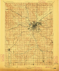
1897 Map of Lincoln
USGS Topo · Published 1909About this map
Lincoln serves as a dense hub for a remarkably complex rail network in the late 19th century, with corridors like the Burlington and Missouri River R. R. and the Chicago Rock Island and Pacific R. R. radiating into the surrounding plains. The city is surrounded by distinct satellite communities including University Place, Havelock, and College View, while the nearby Asylum and Salt Lake mark the immediate western periphery. This landscape is a patchwork of defined townships such as Yankee Hill and Grant, where the grid of sections is already firmly established.
Find a feature on this map
104 named features on this map. Tap any name to fly to it.
Don’t see what you’re looking for? This feature index may not catch every label — zoom into the map to look around manually.
Map Details
Editions of this 1897 Lincoln Map
4 editions found
Other maps of this area

1893 · Fremont
USGS Topo · 1:125,000

1896 · Fremont
USGS Topo · 1:125,000

1897 · Lincoln
USGS Topo · 1:125,000

1899 · Wahoo
USGS Topo · 1:125,000

1899 · David City
USGS Topo · 1:125,000

1903 · Weeping Water
USGS Topo · 1:125,000

1929 · Weeping Water
USGS Topo · 1:125,000

1934 · Seward
USGS Topo · 1:48,000

1935 · Dorchester
USGS Topo · 1:48,000

1939 · Seward
USGS Topo · 1:62,500