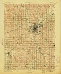
1897 Map of Lincoln
USGS Topo · Published 1913About this map
Lincoln emerges as a burgeoning rail hub in this late nineteenth-century reconnaissance, surrounded by specialized satellite communities like University Place, College View, and the industrial center of Havelock. The landscape is defined by the convergence of several major carriers, including the Burlington and Missouri River R. R. and the Chicago Rock Island and Pacific R. R., reflecting the capital's rapid expansion during this era. Unique features such as the Lincoln Salt Lake and the Asylum south of the city core provide insight into the early geographic and social planning of the region.
Find a feature on this map
92 named features on this map. Tap any name to fly to it.
Don’t see what you’re looking for? This feature index may not catch every label — zoom into the map to look around manually.
Map Details
Editions of this 1897 Lincoln Map
4 editions found
Other maps of this area

1893 · Fremont
USGS Topo · 1:125,000

1896 · Fremont
USGS Topo · 1:125,000

1897 · Lincoln
USGS Topo · 1:125,000

1899 · Wahoo
USGS Topo · 1:125,000

1899 · David City
USGS Topo · 1:125,000

1903 · Weeping Water
USGS Topo · 1:125,000

1929 · Weeping Water
USGS Topo · 1:125,000

1934 · Seward
USGS Topo · 1:48,000

1935 · Dorchester
USGS Topo · 1:48,000

1939 · Seward
USGS Topo · 1:62,500