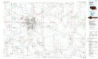
1986 Map of Lincoln
USGS Topo · Published 1986About this map
The Lincoln metropolitan area serves as the central hub of this mid-1980s planimetric study, showcasing the city's complex institutional and transportation infrastructure. Significant landmarks such as the State Capitol, State Hospital, and the State Reformatory anchor the urban landscape, alongside academic centers like the University of Nebraska (East Campus) and Nebraska Wesleyan University. The region's connection to the broader Nebraska plains is defined by a dense network of railroads including the Burlington Northern and Missouri Pacific, which radiate outward toward smaller agricultural communities like Waverly and Syracuse.
Find a feature on this map
154 named features on this map. Tap any name to fly to it.
Don’t see what you’re looking for? This feature index may not catch every label — zoom into the map to look around manually.
Map Details
Editions of this 1986 Lincoln Map
2 editions found
Other maps of this area

1893 · Fremont
USGS Topo · 1:125,000

1896 · Fremont
USGS Topo · 1:125,000

1897 · Lincoln
USGS Topo · 1:125,000

1899 · Wahoo
USGS Topo · 1:125,000

1899 · David City
USGS Topo · 1:125,000

1903 · Weeping Water
USGS Topo · 1:125,000

1907 · Nebraska City
USGS Topo · 1:62,500

1915 · Howe
USGS Topo · 1:62,500

1929 · Weeping Water
USGS Topo · 1:125,000

1934 · Seward
USGS Topo · 1:48,000